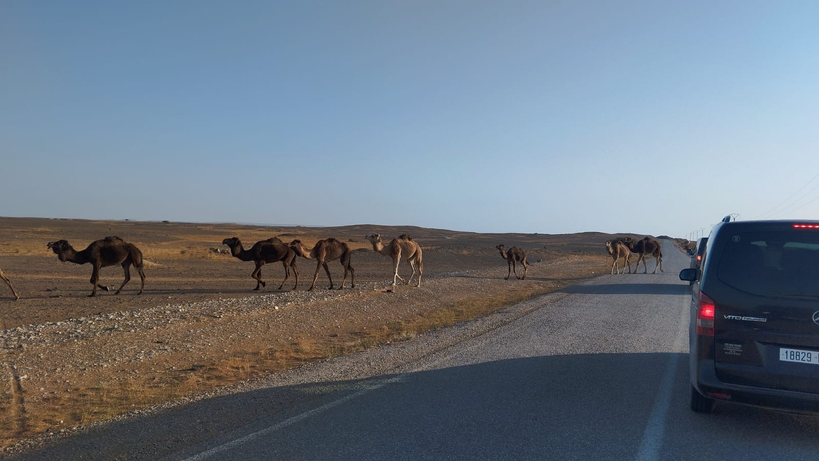
A Morocco road trip is one of the great drives of the world — the High Atlas passes, the kasbah road, the Drâa Valley palm oases and the Saharan pre-desert unfold in sequence. Here is how to plan it, what the roads are actually like and which routes reward a self-driver.
Itineraries · Updated June 2026 · 7 min read
Is it worth self-driving in Morocco?
Self-driving in Morocco rewards those who go in prepared. The motorway network (autoroutes) connecting Casablanca, Rabat, Fes and Marrakech is modern, fast and well-signposted. National roads (RN) across the Atlas passes and into the south are paved and in reasonable condition, though narrower and occasionally damaged. The desert pistes south of M'Hamid and the remote Saharan tracks require a 4WD and local knowledge.
The medinas of Marrakech, Fes and the older city centres are effectively car-free — your hotel or riad will be unreachable by car beyond the city gates. You park at the edge of the medina and walk or take a petit taxi in. This is not a problem; most cities have car parks near the medina gates and many riads offer to meet you at a designated drop-off point.
For travellers who want total freedom of schedule, prefer to stop spontaneously at a viewpoint or a roadside co-operative, and are comfortable with a manual car on mountain switchbacks, self-driving is deeply rewarding. For those who want local context, cultural interpretation and to arrive at their riad without navigation stress, a private driver-guide is the better choice.
What are the best road-trip routes in Morocco?
The classic southern loop from Marrakech — over the Tizi n'Tichka pass, through Aït Ben Haddou, along the kasbah road, through the Dadès and Todra gorges and on to the Sahara at Merzouga — is justifiably the most popular Morocco road trip. It covers approximately 1,000–1,200 km in a 6–8 day circuit and passes through an extraordinary sequence of landscapes: High Atlas, pisé kasbahs, red gorge walls, date-palm oases and finally the orange dunes of Erg Chebbi. The route is almost entirely paved, though the final approach to some Merzouga camps involves a few kilometres of sand piste.
The northern imperial cities loop — Casablanca, Rabat, Meknes, Fes, Chefchaouen, Tangier — follows the Atlantic coast and then the Rif Mountains and is equally spectacular, with better motorway connections and shorter driving days. This suits travellers doing a first trip without desert ambitions, or those on a tighter time frame who still want the medieval imperial cities.
- Southern loop (Marrakech base): Tizi n'Tichka → Ouarzazate → Gorges → Merzouga → return; 6–8 days, 1,000–1,200 km.
- Northern arc (Casablanca to Tangier): Rabat → Meknes → Fes → Chefchaouen → Tangier; 5–7 days, 700–900 km.
- Full grand circuit (open-jaw): Casablanca/Fes in, Marrakech out, via north and south; 12–14 days, 2,000+ km.
- Atlantic coast drive: Agadir → Essaouira → El Jadida → Casablanca; 3–4 days, coastal scenery.
What are the roads actually like in Morocco?
The autoroutes (motorways) are dual-carriageway, well-maintained, and have petrol stations and rest areas at reasonable intervals. Tolls apply; keep small notes in local currency for the toll booths. National roads (N routes) on the Atlas passes — including the Tizi n'Tichka (N9), the Tizi n'Test (N10) and the Tizi n'Tizgui east of Ouarzazate — are narrower, occasionally potholed and involve steep switchbacks, but are entirely manageable in a standard car. The N9 Tizi n'Tichka is the busiest and most reliable; the Tizi n'Test is more dramatic and less trafficked.
In the far south, once you leave the tarmac, pistes (sandy tracks) require a 4WD with high clearance. The most commonly self-driven piste is the approach to the Erg Chigaga dunes from M'Hamid (approximately 50 km of sand and gravel); without 4WD, camp operators will transfer you in their vehicles from M'Hamid. At Merzouga, the approach from Hassi Labied village to most camps is manageable in a standard car for the first few kilometres.
Practical tips for self-driving in Morocco
Fuel: petrol and diesel are widely available in cities and on the main routes; fill up in Ouarzazate and Errachidia before heading into the desert, as stations become sparse. Accept payment only in cash at rural stations. Download offline maps before you set off — Google Maps coverage deteriorates off the main roads and in the Atlas, and mobile data is intermittent.
Driving style: Moroccan road culture involves heavy horn use, passing on blind corners on mountain roads, and pedestrians, mules and livestock sharing the road in rural areas. Drive defensively, anticipate the unexpected and do not rush the mountain passes. Speed cameras are active on the autoroutes; speed limits are enforced (120 km/h motorway, 100 km/h national road, 40–60 km/h in towns).
Documents: bring your driving licence, passport and rental agreement at all times. Gendarmerie checkpoints are common in the south — stop calmly, hand over your passport, and you will be waved through in seconds.
- Car hire: a standard automatic hatchback covers all paved routes; 4WD needed only for Erg Chigaga piste.
- Rental companies: international brands (Hertz, Europcar, Sixt) at Marrakech RAK and Casablanca CMN airports are reliable.
- Fuel: fill up before the desert; keep a 10-litre jerry can for very remote piste driving.
- Offline maps: download Google Maps Morocco or Maps.me offline before leaving the city.
- Road police: gendarmerie checkpoints are routine — stop, be polite, and produce documents on request.
What is the best season for a Morocco road trip?
March to May and September to November are the ideal road-trip seasons. Spring brings wildflowers in the Atlas valleys and the rose harvest in the Dadès in late April; autumn brings golden light on the gorges and the Sahara season at its best. Summer (July–August) makes inland driving genuinely uncomfortable — the car heats up fast, rest stops are scarce and air-conditioned, and the Sahara becomes an ordeal rather than a highlight.
The Tizi n'Tichka pass can close in January and February after heavy snowfall, which affects the Marrakech–Ouarzazate route. Check road conditions (the Gendarmerie Royale or Google Maps often shows closures in near-real time) if your trip falls in winter. An alternative in case of pass closure is the longer route via Agadir and the Souss plain.